Randonnée Marche La Celle-sous-Chantemerle - Boucle la celle vers Chantemerle Bethon - Photo

Boucle la celle vers Chantemerle Bethon

 NANE51
NANE51

Utilisateur

© OpenStreetMap contributors
Longueur
Longueur
12,4 km
Altitude max
Altitude max
209 m
Dénivelé positif
Dénivelé positif
211 m
Km-Effort
Km-Effort  
15,2 km
Altitude min
Altitude min
116 m
Dénivelé négatif
Dénivelé négatif
213 m
Boucle
Boucle
Oui
Date de création :
2021-01-31 08:00:00.0
Dernière modification :
2021-01-31 10:59:50.428

(0 Avis)

Marche
Marche
2h59
Difficulté : Inconnu

Scannez ce code QR pour ouvrir la randonnée dans l'application SityTrail

Application GPS de randonnée GRATUITE

Logo SityTrail SityTrail

IGN / Instituts géographiques

Télécharger SityTrail sur l'App Store Télécharger SityTrail sur Google Play

Logo SityTrail SityTrail World

Le monde est à vous

Télécharger SityTrail sur l'App Store Télécharger SityTrail sur Google Play Télécharger SityTrail sur Huawei AppGallery

À propos

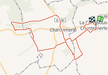
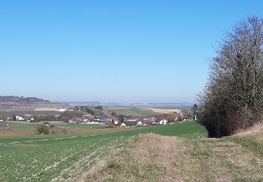
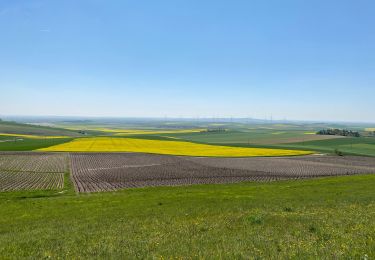
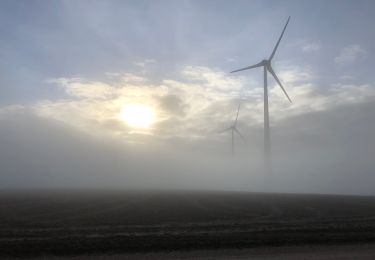
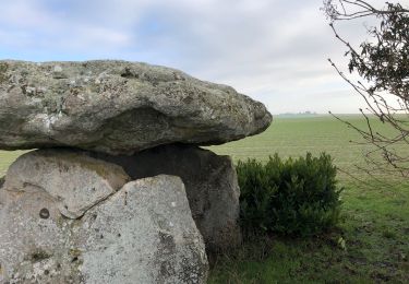
Randonnée Marche de 12,4 km à découvrir à Grand Est, Marne, La Celle-sous-Chantemerle. Cette randonnée est proposée par NANE51.

Description

Départ du parking de l’église

Profil altimétrique

Localisation

Pays :
France
Région :
Grand Est
Département/Province :
Marne
Commune :
La Celle-sous-Chantemerle
Localité :
Unknown
Départ:(Dec)
Départ:(UTM)
549992 ; 5384655 (31U) N.

Randonnées à proximité

Randonnée Marche Barbonne-Fayel - dans le vignoble Champenois autour de BARBONNE-FAYEL - Photo
Marche
jeannine grandjean

Marche

Facile
Barbonne-Fayel, Grand Est, Marne, France
11,7 km | 14 km-effort
4h 27min
Oui
Randonnée Marche Potangis - Boucle Potangis Le Perre Chantemerle Bethon - Photo
Marche
NANE51

Marche

Facile
Potangis, Grand Est, Marne, France
16,4 km | 19,6 km-effort
3h 33min
Oui
Randonnée Marche Saron-sur-Aube - Boucle Saron les éoliennes  - Photo
Marche
NANE51

Marche

Saron-sur-Aube, Grand Est, Marne, France
9,1 km | 10 km-effort
1h 51min
Oui
Randonnée Marche Saint-Quentin-le-Verger - Boucle Dt Quentin le Verger  - Photo
Marche
NANE51

Marche

Très facile
Saint-Quentin-le-Verger, Grand Est, Marne, France
12,7 km | 14,3 km-effort
2h 42min
Oui
Randonnée Marche La Celle-sous-Chantemerle - la celle bois de fontaine denis nuisy - Photo
Marche
annisette10

Marche

Difficile
La Celle-sous-Chantemerle, Grand Est, Marne, France
12,5 km | 15,5 km-effort
3h 31min
Oui
Randonnée Marche Villiers-aux-Corneilles - Villiers, Chantemerle, Potangis  - Photo
Marche
NANE51

Marche

Facile
(1)
Villiers-aux-Corneilles, Grand Est, Marne, France
12,7 km | 15,2 km-effort
3h 27min
Oui
Randonnée A pied Bethon - Bethon-Montgenost - Photo
A pied
Alain Picard

A pied

Moyen
Bethon, Grand Est, Marne, France
9,7 km | 11,9 km-effort
Inconnu
Oui
Randonnée A pied Barbonne-Fayel - Barbonne-Fayel , - Photo
A pied
Alain Picard

A pied

Facile
Barbonne-Fayel, Grand Est, Marne, France
9 km | 11,3 km-effort
2h 30min
Oui
Randonnée A pied Barbonne-Fayel - RD Barbonne Lancourt - Photo
A pied
Alain Picard

A pied

Très facile
Barbonne-Fayel, Grand Est, Marne, France
7,2 km | 9 km-effort
Inconnu
Oui


Fermer
Mes abonnements